UN
7 Heath Rise
£ 730,000
Description
We don't have a Description for this property.
- Bedrooms
- 5
- Bathrooms
- 0
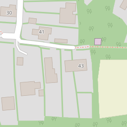

Leaflet © OpenStreetMap contributors
The heatmap indicates the level of crime in the area. The color of the heatmap indicates the crime severity and recency.
Metrics Year-on-Year
- Average area value
- 1,081,875.00 £Increased by 109.89 %
- Average area rental value
- 2,269.00 £/moIncreased by 48.79 %
- Est rental Yield
- 2.52 %Decreased by 29.01 %
- Crime Rate
- 104.00 %Unchanged by 0.00 %
from 515,455.00 £
from 1,525.00 £/mo
from 3.55 %
from 104.00 %
Nearby Schools
| Name | Type | Ofsted | Distance |
|---|---|---|---|
| Surrey Hills All Saints Primary School | Academy Sponsor Led | 0.85 KM | |
| Powell Corderoy Primary School | Voluntary Controlled School | Good | 2.60 KM |
| The Priory Cofe Voluntary Aided School | Voluntary Aided School | Good | 2.92 KM |
| St Joseph'S Catholic Primary School | Voluntary Aided School | Good | 3.51 KM |
| St Martin'S Cofe Controlled Primary School, Dorking | Voluntary Controlled School | Good | 3.54 KM |
Images
Nearby Streets
| Name | Average Price | Average Sqft | Distance |
|---|---|---|---|
| Parsonage Close | £ 225,000 | 0 | 0.00 KM |
| North Street | £ 525,000 | 0 | 0.00 KM |
| FP 600 | £ 1,850,000 | 0 | 0.00 KM |
| Stones Lane | £ 0 | 0 | 0.00 KM |
| FP 117 | £ 0 | 0 | 0.00 KM |
Nearby Transport
| Name | NLC | TLC | Distance |
|---|---|---|---|
| Dorking West | 5297 | DKT | 3.38 KM |
| Dorking (Deepdene) | 5412 | DPD | 5.07 KM |
| Dorking | 5357 | DKG | 5.19 KM |
| Box Hill And Westhumble | 5403 | BXW | 5.50 KM |
| Holmwood | 5308 | HLM | 7.04 KM |
Nearby Listings
| Address | Price | Type | Score | Distance |
|---|---|---|---|---|
| Heath Rise, Westcott RH4 | £ 375,000 | BUY | Unknown | 0.03 KM |
| Parsonage Close, Westcott | £ 225,000 | BUY | 5 / 10 | 0.13 KM |
| Westcott Mews, Westcott, DORKING | £ 575,000 | BUY | 7 / 10 | 0.16 KM |
| WESTCOTT MEWS, WESTCOTT, RH3 | £ 575,000 | BUY | Unknown | 0.20 KM |
| Parsonage Lane, Westcott | £ 625,000 | BUY | 6 / 10 | 0.20 KM |
Nearby Properties
| Address | Price | Distance |
|---|---|---|
| 13 Heath Rise | £ 653,000 | 0.00 KM |
| 7 Heath Rise | £ 730,000 | 0.00 KM |
| 19 Heath Rise | £ 306,000 | 0.00 KM |
| 4 Heath Rise | £ 425,000 | 0.00 KM |
| 2 Heath Rise | £ 230,000 | 0.00 KM |